Antique Italian Maps at the Vittoriano
I warn you now, dearest bloglings, the Pines of Rome is going to get a bit exhibit-heavy in the next few days. There are just so many amazing mostre on right now! One in particular, free of charge and hosted at the Complesso del Vittoriano, took me three weeks to see because of two weekend snowstorms in Rome that saw nearly every site in the city closed all weekend.
I finally had a chance to visit this small but lovely exhibit weekend before last, Antica Cartografia d'Italia. Beautiful detailed maps dating from the 1500s onward are on display, making for a lovely and enjoyable pre-lunch outing. In addition to maps, illustrated cover pages of antique atlases are also on display.
This exhibit was a real treat for me due to my life-long love of maps. I inherited this passion from my father, and I can spend hours pouring over them. My favorite are city maps, especially when they allow me to study how that particular city has changed and expanded over time, as well as how they have stayed the same. Alas, very few city maps are to be seen at this exhibit, but the region and country maps are nevertheless absorbing.
By far the most amusing and enlightening maps on view at this exhibit are the comical ones, most of which depict Europe during World War I, although some date back to the late 1800s. We've all seen and laughed over the clever and often spot-on images like the ones below by Yanko Tsvetkov that depict Europe or the world according to specific groups or nationalities.
But who knew this type of satirical map dated back at least 150 years? The main difference is that the old Italian ones are even more astute and more artistically rendered. (Please forgive the quality of the next four photos, I took them myself.)
The map above depicts Europe at the onset of World War One with the various countries depicted in canine form while Russia literally steam-rolls in. Germany and Austria are tethered together as Britain releases his mighty fleet of ships. Spain is still bullfighting and Italy is a pistol-weilding carabiniere.
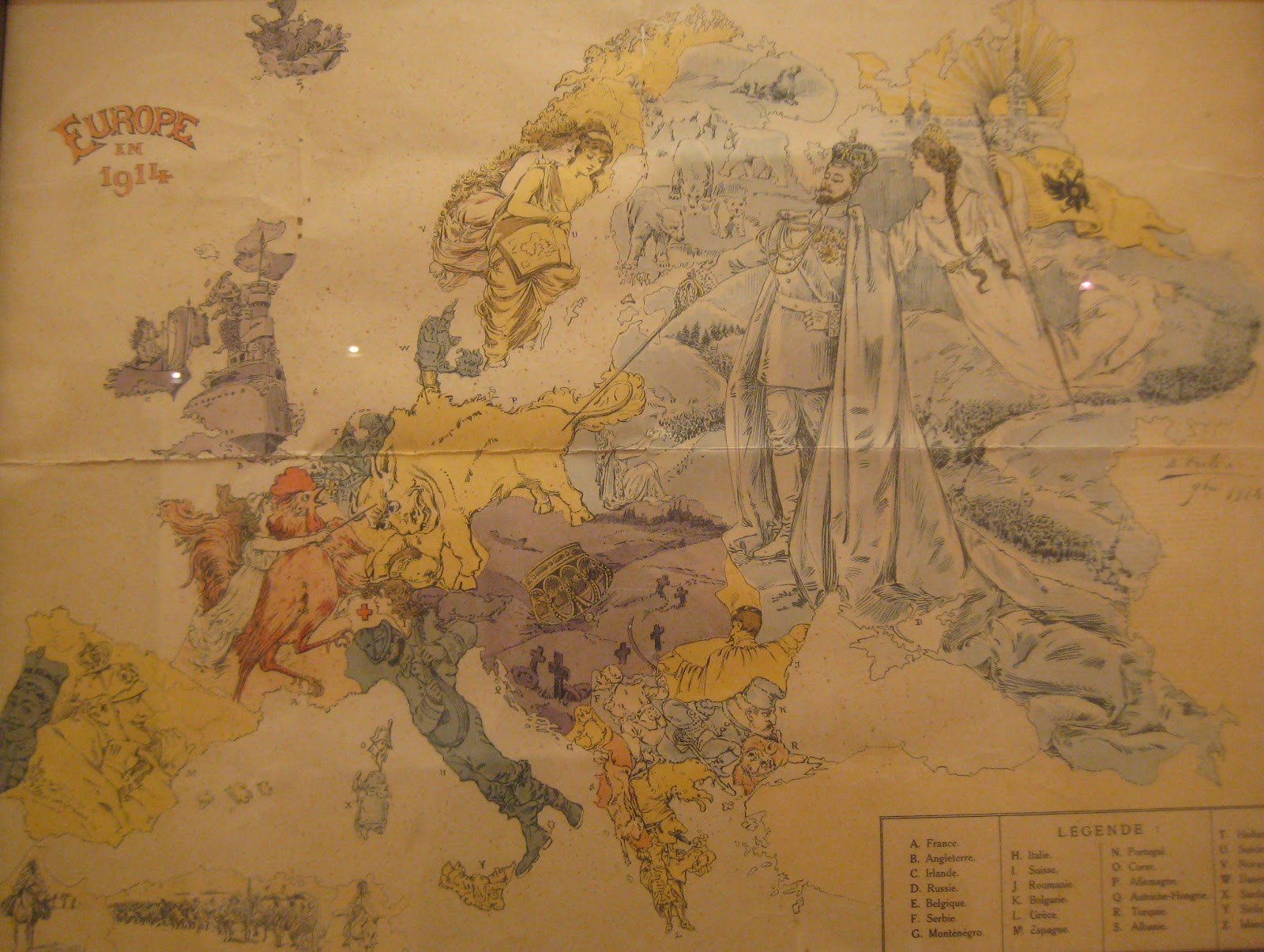
The map above is dominated by the Tsar of Russia. I love that nothing is going on in Finland except a few bears prowling around, while Sweden and Norway look on calmly and the Austro-Hungarian Empire is already a graveyard (literally).
Kill that Eagle shows a female but nevertheless fierce France attempting to pierce the German eagle, with Britain rolling up his sleeves to join the fight. Austria, depicted as a clown, is torn between Germany and Yugoslavia and looks in terror as the Russia literally bears down upon him. Spain and Scandinavia are nothing but idle spectators while Italy appears to be either singing or reciting poetry. Typical.
In the map above dated 1900, Russia is a menacing octopus strangling Poland and Siberia with tentacles reaching from Finland to China. France, Spain and Ireland are depicted as women while the rest of Europe, a choatic mess, are weapon bearing military leaders. The cleverest detail is the red Salwar pants that illustrate Turkey, who is literally leaning on Greece.
But this one below is by far my favorite. It sums up perfectly the Unification of Italy with triumphant Giuseppe Garibaldi ousting Pope Pius IX (Sardinia) and his Papal Tiara (Corsica).
Photo sources: 5, 6, 7 by Yanko Tsvetkov 8, 9, 10, 11 by author.
All other images provided courtesy of Comunicare Organizzando press office.


